Historic pocket
Park Drive–Bascom Pocket
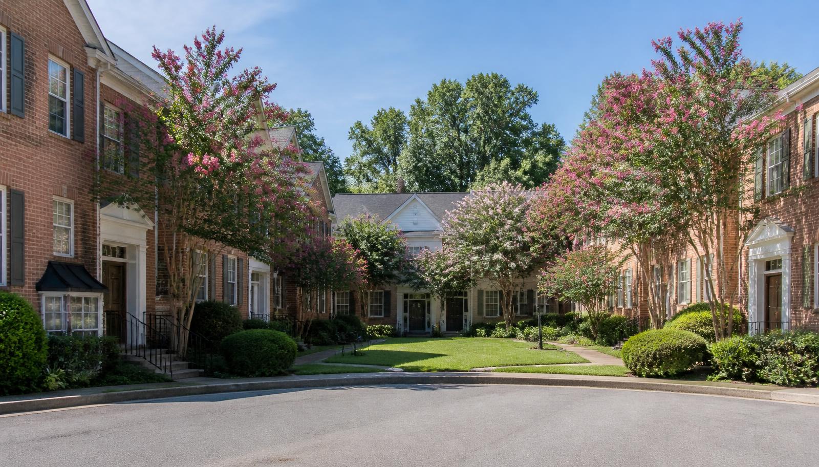
Streets curving along Independence Park's western edge, blending direct park access with a quieter residential feel than the park's main frontage.
Streets curving along Independence Park's western edge, blending direct park access with a quieter residential feel than the park's main frontage.
About Park Drive–Bascom Pocket
Park Drive and Bascom Street trace the western edge of Independence Park, offering park proximity similar to the more prominent park-frontage blocks but at a slightly lower profile and, historically, a somewhat lower price point.
The curving street layout here departs from the district's otherwise rigid grid, a result of the land's original topography along a small tributary that was later channeled underground, and it gives the pocket a distinct visual identity within the neighborhood.
Houses are a consistent run of bungalows with a handful of Tudor Revival cottages mixed in, most retaining their original porches and many with updated systems following renovation waves in the 2000s and 2010s.
The curve in these streets is a piece of legible history. Charlotte's early suburbs were laid out in grids wherever the land allowed, and where the pavement bends it is usually because water once ran there. A small tributary shaped this alignment before it was culverted and built over, and the street simply kept the line. That makes for an unusually pleasant streetscape — sightlines shift as you walk, and no two blocks read alike — and it also means the ground under these lots has a drainage history worth understanding.
So the practical diligence here is water. Ask specifically about crawlspace moisture, sump equipment, foundation repair history, and how the lot performs during a heavy summer thunderstorm rather than a light rain. A buried stream channel does not make a house problematic, but it does make drainage the first thing an inspector should examine and the last place to accept a reassuring generality. Requesting a look after rain, or at least photographs from the current owner, is entirely reasonable.
What the pocket delivers is park proximity slightly off the premium frontage. Residents reach Independence Park's western edge on foot in a minute or two, without paying for a direct park view or absorbing the parking and event pressure that comes with facing the lawn. The housing is a consistent run of bungalows with a scattering of Tudor Revival cottages, most through at least one round of systems modernisation over the past two decades, which puts a buyer's near-term capital exposure below what an untouched house elsewhere would carry.
What defines it
- Curving street layout distinct from the district's grid
- Direct proximity to Independence Park's western edge
- Mix of bungalows and Tudor Revival cottages
- Two prior decades of steady renovation activity
Housing summary
| Type | Historic pocket |
|---|---|
| Building era | 1908–1922 |
| Scale | roughly 45 homes |
| Typical range | $525,000–$975,000 |
| Principal streets | Park Drive, Bascom Street |
Ranges are general characterizations rather than appraisals, and turnover in a market this small can move them quickly. Verify current figures against Canopy MLS and parcel records on Mecklenburg County POLARIS before relying on them.
Block by block
Streets in and around Park Drive–Bascom Pocket
Character, building era, and daily conditions street by street.
Keep exploring
Other communities and enclaves
Local representation
Looking at Park Drive–Bascom Pocket?
Condition, review requirements, and street-level differences drive value here more than any neighborhood average. Peters & Associates works Elizabeth specifically and can walk a property with you before you write an offer.
Charlotte Real Estate
Peters & Associatesyourleaderinluxury.comAdvertising disclosure. This is a paid or affiliated relationship: the firm above is affiliated with or compensates the publisher of this independent guide, and contacting it may result in a commercial engagement. It does not buy editorial placement. Full disclosure.
Questions & Answers
Frequently asked questions
Direct answers to what readers most often ask about this section of the guide. Each answer cites the primary source it rests on.
All Elizabeth questions →Why do these streets curve instead of following a grid?
The curve follows the original contour of a small stream that was later piped underground as the neighborhood developed, a common pattern in early-twentieth-century streetcar suburbs.
Source: City of Charlotte tree canopy and tree ordinance program
Is this pocket priced similarly to the park's main frontage streets?
Historically it has traded slightly below the most prominent park-frontage addresses, though buyers should check current comparable sales for an accurate picture.
Source: City of Charlotte tree canopy and tree ordinance program
Does the buried stream channel cause problems for houses here?
Not inherently, but it makes drainage the priority in any inspection. Ask about crawlspace moisture, sump equipment and foundation repair history, and try to observe the lot during or just after a heavy rain rather than relying on a dry-day walkthrough.
Source: City of Charlotte / Mecklenburg County Code Enforcement permitting
How does pricing compare to the park's main frontage streets?
Historically a step below. You are a minute's walk from the same park without paying for direct frontage, and without the event parking and activity noise that comes with facing the lawn — which is precisely the trade many buyers here are making deliberately.
Source: City of Charlotte tree canopy and tree ordinance program
Our Sources
How this page was researched
This guide is independently written and verified against primary public records and official organizations. It is not affiliated with, endorsed by, or representing any neighborhood association, hospital, college, school district, or governing body.
Read our full citation methodology and editorial standards- 01POLARIS 3G property and parcel records
Mecklenburg County GIS
Parcel boundaries, lot sizes, ownership, and sale history.
- 02Charlotte-region housing market reports
Canopy Realtor® Association / Canopy MLS
Regional price, inventory, and days-on-market trends.
- 03Survey and designation records for Charlotte's historic neighborhoods
Charlotte-Mecklenburg Historic Landmarks Commission
Historic designation, survey history, and landmark property records.
- 04Local historic district design standards and review process
City of Charlotte Historic District Commission
Certificate of Appropriateness requirements for exterior work.
Figures such as pricing, assessments, business hours, and school assignment change over time. Always confirm current details directly with the source before making a decision.
Topic Cluster
Elizabeth Homes & Market
Housing stock, price bands, enclaves, and street-level value.
The Elizabeth Guide — Elizabeth Homes & Market →Elizabeth Homes & Real Estate
Housing stock, price bands, and how this small historic market actually trades.
Continue →Elizabeth Neighborhood, Charlotte NC
The whole neighborhood on one page: place, history, architecture, district, market, and daily life.
Continue →Elizabeth Market Data
Price per square foot, inventory, and what drives value street to street.
Continue →Communities, Buildings & Enclaves
Every pocket, condo building, and infill community in and around Elizabeth.
Continue →Local Expertise
Work with the firms behind this guide
Last reviewed August 1, 2026. This guide keeps no contact form and no inbox — inquiries go directly to the firms below.