Getting Around
Walkability & Getting Around
The sidewalk network, walk times to real landmarks, the streetcar, bikes, and parking, block by block.
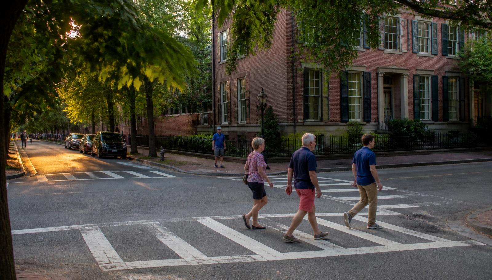
Elizabeth was built before the automobile reorganized American neighborhoods, and its layout still shows it: a tight grid of short blocks, sidewalks on most residential streets, and a genuine main street in Seventh Street and Elizabeth Avenue. That legacy layout is the single biggest reason Elizabeth ranks among Charlotte's more walkable in-town neighborhoods, but walkability here is not uniform — it depends heavily on which block you're standing on and which direction you're headed.
The sidewalk network
Most of Elizabeth's interior residential streets have sidewalks on at least one side, a legacy of the neighborhood's early-twentieth-century platting. Coverage is not perfect — some blocks have gaps, uneven original concrete, or sections interrupted by driveways — but on the whole it is far more complete than in Charlotte's postwar suburban neighborhoods. The boundary roads carrying heavier traffic have sidewalks as well, though crossing them is more comfortable at signalized or marked crossings than midblock.
Realistic walk times to real landmarks
From a typical interior block near the neighborhood's center, Independence Park is roughly a five-to-ten-minute walk, the Seventh Street restaurant cluster is similarly close, and the Elizabeth Avenue corridor with its shops, transit stop, and institutional anchors is another five-to-ten-minute walk depending on which edge of the neighborhood you start from. Uptown Charlotte is about a mile and a half away — walkable for some, but more commonly covered by streetcar, bike, or a short drive. Actual walk times vary meaningfully by specific address, so treat these as general ranges rather than fixed figures for any one house.
Streetcar and bus
The CityLYNX Gold Line streetcar runs along a route serving the Elizabeth Avenue corridor, connecting to uptown and the Charlotte Transportation Center, where riders can transfer to the broader CATS bus network and the light-rail Blue Line. Several bus routes also serve the neighborhood's boundary streets. Route maps, schedules, and any construction detours change over time and should be confirmed directly with Charlotte Area Transit System before planning a trip around them.
Bike routes
Charlotte has steadily expanded marked bike lanes and routes through and around Elizabeth, including connections toward uptown and to the Little Sugar Creek Greenway along the neighborhood's western edge, which offers a car-free path south toward Midtown and Freedom Park. Because the city's bike network continues to be built out in phases, check the current official bike map for up-to-date route conditions before relying on a specific connection.
Parking realities
Most residential streets have unmetered on-street parking available to residents and visitors, but many of Elizabeth's original houses predate the automobile and were built with little or no off-street parking, so competition for curb space can be real, particularly near Seventh Street on weekend evenings and near the hospital and college campuses on weekdays. Buyers who need guaranteed off-street parking should confirm a specific property's driveway or garage situation rather than assume one exists.
Uptown access
Elizabeth's proximity to uptown — about a mile and a half — is one of its strongest draws for commuters who work downtown, whether they choose to walk on a nice day, ride the streetcar or a bus, bike a marked route, or drive the short distance and park. That range of realistic options is part of what distinguishes Elizabeth from Charlotte's more car-dependent suburbs.
Parks & Greenways
Independence Park
Center from Elizabeth
Charlotte's first public park (1904) — pond, rose garden, ball fields, and the neighborhood's green heart.
Browse 20 places
Living in Elizabeth
Continue through the Living guide
Choosing the right block
Walkability varies more block to block than most buyers expect
Peters & Associates can walk a specific address with you and time the real distance to the park, transit, and dining before you commit.
Charlotte Real Estate
Peters & Associatesyourleaderinluxury.comAdvertising disclosure. This is a paid or affiliated relationship: the firm above is affiliated with or compensates the publisher of this independent guide, and contacting it may result in a commercial engagement. It does not buy editorial placement. Full disclosure.
Questions & Answers
Frequently asked questions
Direct answers to what readers most often ask about this section of the guide. Each answer cites the primary source it rests on.
All Elizabeth questions →Is Elizabeth a walkable neighborhood?
Yes, relative to most of Charlotte. Elizabeth's original streetcar-suburb layout gave it a tight grid, short blocks, and sidewalks on most residential streets, which puts many daily errands within a genuine walk. Walkability varies by block, and crossing the busier boundary roads is more comfortable at marked crossings than midblock.
Source: City of Charlotte tree canopy and tree ordinance program
How do I get from Elizabeth to uptown Charlotte?
Uptown is roughly a mile and a half from the center of Elizabeth, reachable by the CityLYNX Gold Line streetcar, several CATS bus routes, a bicycle on marked routes, or a five-to-ten-minute drive depending on traffic and parking. Always check current CATS schedules and any service changes before planning a trip around transit.
Source: City of Charlotte tree canopy and tree ordinance program
Are there bike lanes or routes in Elizabeth?
Charlotte has expanded marked bike routes and lanes through and around Elizabeth over time, connecting toward uptown and the Little Sugar Creek Greenway. Route conditions and connections change as the city's bike network is built out, so check the city's current bike map before planning a specific route.
Source: Mecklenburg County greenways — Little Sugar Creek Greenway
Is parking difficult in Elizabeth?
Most residential streets have unmetered on-street parking, but many older houses have limited or no off-street parking, and parking can be tight near the Seventh Street restaurant cluster on weekend evenings and near the hospital and college campuses on weekdays.
Source: City of Charlotte tree canopy and tree ordinance program
Can I live in Elizabeth without a car?
Some residents manage with minimal car use, relying on walking, the streetcar, and occasional rideshare, particularly if they work uptown or at the adjacent hospital or college. Most households still keep at least one car for errands, work outside the immediate area, and trips beyond the reach of transit.
Source: City of Charlotte tree canopy and tree ordinance program
Our Sources
How this page was researched
This guide is independently written and verified against primary public records and official organizations. It is not affiliated with, endorsed by, or representing any neighborhood association, hospital, college, school district, or governing body.
Read our full citation methodology and editorial standards- 01Transit routes, the Gold Line streetcar, and commute planning
Charlotte Area Transit System
Streetcar, bus, and rail options serving the neighborhood.
- 02Unified Development Ordinance and zoning maps
City of Charlotte
Zoning districts, setbacks, height, and permitting rules.
- 03Parks, greenways, and recreation directory
Mecklenburg County Park and Recreation
Independence Park, greenway access, and nearby recreation.
Figures such as pricing, assessments, business hours, and school assignment change over time. Always confirm current details directly with the source before making a decision.
Topic Cluster
Living in Elizabeth
Dining, parks, schools, transit, and the daily rhythm of the neighborhood.
The Elizabeth Guide — Living in Elizabeth →Transit & the Gold Line
The streetcar, bus routes, uptown commute, and airport drive times.
Continue →Living in Elizabeth
The daily rhythm — porches, dog walks, the park loop, and dinner four blocks away.
Continue →Elizabeth Restaurants & Dining
Every restaurant, café, bakery, and bar within walking distance.
Continue →Parks & Greenways
Independence Park, Little Sugar Creek, Alexander Street, and the pocket greens.
Continue →Local Expertise
Work with the firms behind this guide
Last reviewed August 1, 2026. This guide keeps no contact form and no inbox — inquiries go directly to the firms below.