Directory
Streets of Elizabeth
In a neighborhood this old, the block matters as much as the address. This is what each street is actually like.
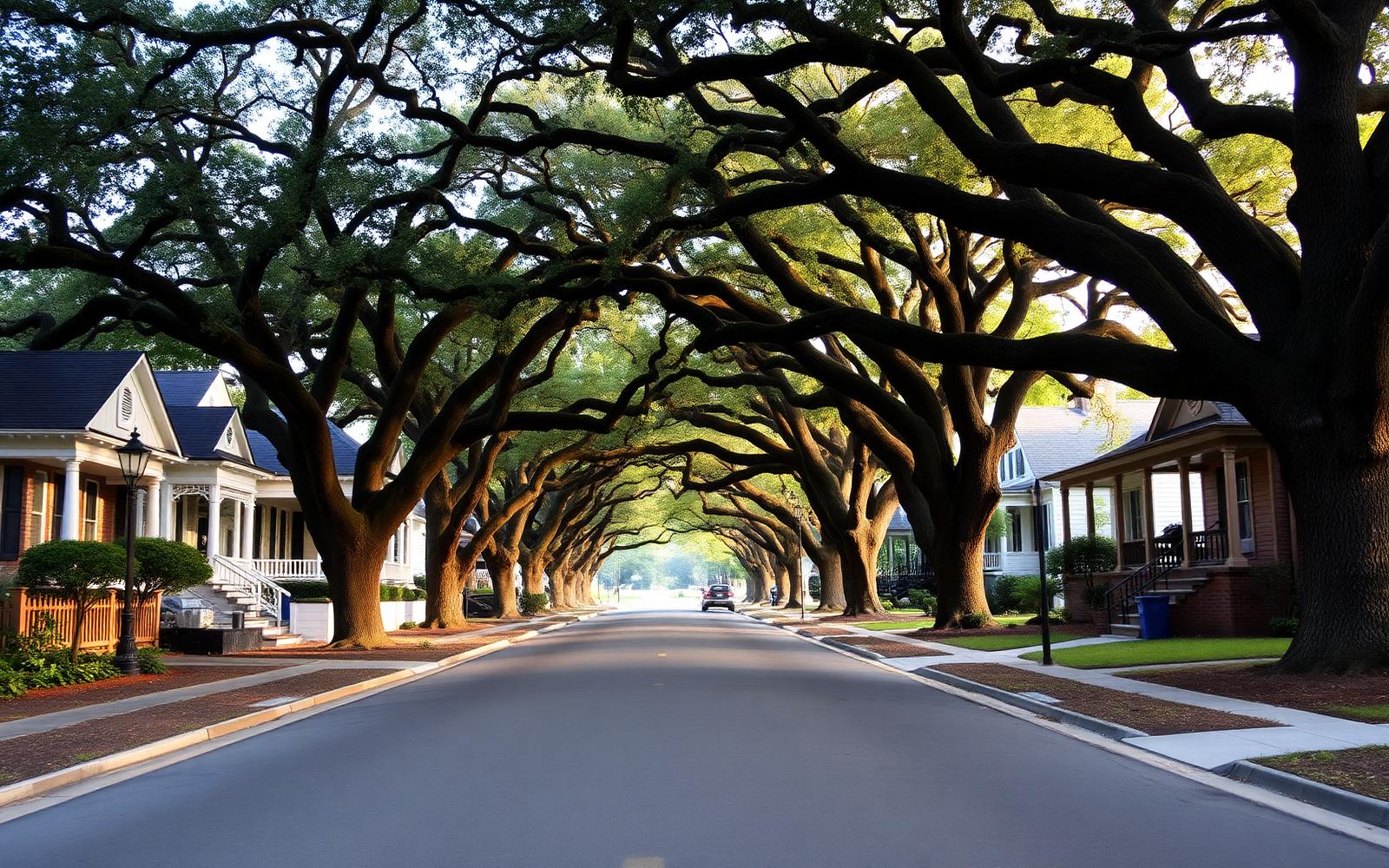
Elizabeth was laid out as a streetcar suburb, so its streets were designed to be walked rather than driven. That decision is still legible: narrow lots, shallow front setbacks, deep porches facing the sidewalk, and a willow oak canopy that closes overhead on the best blocks. But the neighborhood is more than a century into its life, and the differences between streets have widened.
What each street page covers
For every street we describe where it sits in the neighborhood, when its houses were built, which architectural styles dominate, and the daily conditions that shape living there — traffic volume, canopy coverage, walking distances, and parking. Adjacent streets and the communities that contain each street are linked so you can move through the grid the way you would on foot.
Characterizations are general. Parcel-specific facts — historic district status, setbacks, easements, flood zone — should always be confirmed against Mecklenburg County POLARIS records for the exact address.
4 streets
B
4 streets
C
3 streets
P
Local representation
Choosing between two blocks?
Canopy, traffic, lot width, and event-weekend parking vary street to street in ways that no listing photo shows. Peters & Associates can walk both blocks with you before you commit.
Charlotte Real Estate
Peters & Associatesyourleaderinluxury.comAdvertising disclosure. This is a paid or affiliated relationship: the firm above is affiliated with or compensates the publisher of this independent guide, and contacting it may result in a commercial engagement. It does not buy editorial placement. Full disclosure.
Questions & Answers
Frequently asked questions
Direct answers to what readers most often ask about this section of the guide. Each answer cites the primary source it rests on.
All Elizabeth questions →Which streets are considered the most desirable in Elizabeth?
Preferences vary, but the interior streets with the fullest willow oak canopy, consistent setbacks, and largely intact early-twentieth-century houses tend to draw the most competition. Streets closer to Hawthorne Lane, Elizabeth Avenue, or the medical campuses carry more traffic in exchange for shorter walks to work and amenities.
How can I tell whether a specific street is in the historic district?
Do not rely on the street name. The locally designated boundary follows parcels, not full streets, so confirm any address with the Charlotte Historic District Commission and the Charlotte-Mecklenburg Historic Landmarks Commission before planning exterior work.
Source: Charlotte Historic District Commission — design standards
What is parking like on Elizabeth's residential streets?
Most parking is on-street. Driveways on many lots predate two-car households, so overflow parking is normal, and it tightens noticeably on blocks near Independence Park during events and near the commercial cluster on East 7th Street.
Source: City of Charlotte tree canopy and tree ordinance program
Are the mature trees protected?
Charlotte maintains a tree canopy and tree ordinance program, and removals — particularly of large street trees — are regulated. Check current requirements with the City of Charlotte before assuming a tree can come down for a driveway, addition, or utility run.
Do houses on the same street sell in the same range?
Rarely. Lot width, original square footage, whether an addition was done well, and the condition of wiring, plumbing, foundation, and roof create wide spreads within a single block. Street-level character sets the ceiling; condition sets where in that band a house lands.
Source: City of Charlotte tree canopy and tree ordinance program
Our Sources
How this page was researched
This guide is independently written and verified against primary public records and official organizations. It is not affiliated with, endorsed by, or representing any neighborhood association, hospital, college, school district, or governing body.
Read our full citation methodology and editorial standards- 01POLARIS 3G property and parcel records
Mecklenburg County GIS
Parcel boundaries, lot sizes, ownership, and sale history.
- 02Survey and designation records for Charlotte's historic neighborhoods
Charlotte-Mecklenburg Historic Landmarks Commission
Historic designation, survey history, and landmark property records.
- 03Local historic district design standards and review process
City of Charlotte Historic District Commission
Certificate of Appropriateness requirements for exterior work.
- 04Tree canopy program and tree ordinance
City of Charlotte
Canopy protection rules affecting construction and lot work.
Figures such as pricing, assessments, business hours, and school assignment change over time. Always confirm current details directly with the source before making a decision.
Topic Cluster
Elizabeth Homes & Market
Housing stock, price bands, enclaves, and street-level value.
The Elizabeth Guide — Elizabeth Homes & Market →Elizabeth Homes & Real Estate
Housing stock, price bands, and how this small historic market actually trades.
Continue →Communities, Buildings & Enclaves
Every pocket, condo building, and infill community in and around Elizabeth.
Continue →Elizabeth Architecture
Reading Craftsman, Colonial Revival, foursquare, and Tudor detail on one street.
Continue →The Bungalow Field Guide
Plan types, porch forms, and how to price an original against a flip.
Continue →Local Expertise
Work with the firms behind this guide
Last reviewed August 1, 2026. This guide keeps no contact form and no inbox — inquiries go directly to the firms below.