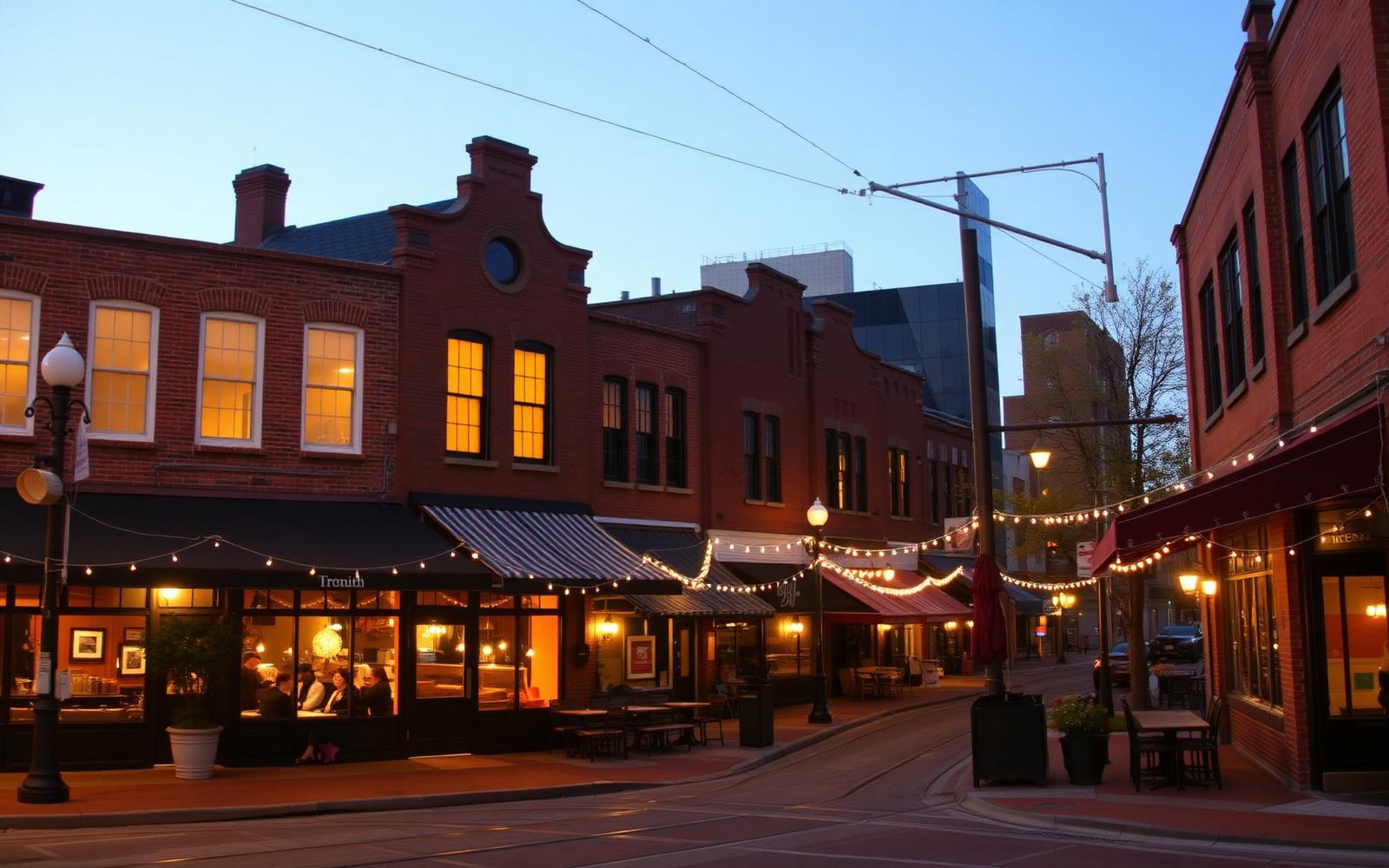
The Corridor
The Elizabeth Avenue Corridor
Streetcar, college, hospital, and redevelopment along the neighborhood's namesake main street.
Every neighborhood of Elizabeth's age has a spine street that explains why it exists where it does, and here that street is Elizabeth Avenue. It was laid out as the neighborhood's commercial and transit backbone when the streetcar suburb was platted in the early 1900s, and more than a century later it still carries that same role: transit, institutions, and commerce, wrapped by residential blocks on either side.
Streetcar-era origins
Elizabeth grew up along a streetcar line extending east from uptown Charlotte, one of several such lines that created the city's first ring of in-town streetcar suburbs, Dilworth among them. The avenue's width, its commercial storefront pattern, and its role as the neighborhood's main street all trace back to that original streetcar-suburb layout, even though the original rail line was decommissioned decades before the modern streetcar returned.
The Gold Line streetcar today
The CityLYNX Gold Line, Charlotte's modern streetcar, runs along a route that connects uptown to Elizabeth and neighborhoods beyond, with a stop serving the corridor. For residents without a car-dependent commute, it is a genuine option for reaching uptown's offices, the Charlotte Transportation Center, and connections to the broader bus and light-rail network. Route segments, service hours, and any construction-related detours should always be confirmed with Charlotte Area Transit System before a trip, since transit service details change.
Central Piedmont and the hospital anchors
Two large institutions bookend the corridor's role in daily life. Central Piedmont Community College's Central Campus sits at the western end, bringing students, faculty, theatres, and galleries that are open to the public. Novant Health Presbyterian Medical Center, a full-service hospital campus operating in the neighborhood since 1918, anchors a stretch nearer uptown. Together, these two institutions generate a daytime population much larger than the neighborhood's residential count alone, which is a large part of why the corridor supports more restaurants and services than a purely residential street of Elizabeth's size otherwise would.
Related reading
Redevelopment and what it means for residents
Elizabeth Avenue has been a steady focus of infill and mixed-use redevelopment for years, with newer apartment-over-retail buildings replacing older strip-commercial parcels in places. That redevelopment brings new restaurants, denser housing options, and improved streetscaping, but it also changes the corridor's traffic patterns and construction noise in the near term. Because the corridor sits just outside much of the locally designated historic district's interior, it is subject to standard city zoning rather than historic design review, which is why its architecture reads differently from the bungalow blocks around it.
What it means for buyers
Property fronting or immediately adjacent to Elizabeth Avenue trades on a different logic than interior residential blocks: more walkable to restaurants and transit, but more exposed to traffic noise, and more likely to see continued redevelopment nearby over time. Buyers who value walkability and don't mind ambient street activity often prefer these corridor-adjacent blocks; buyers prioritizing quiet typically look a block or two further into the neighborhood's interior.
Living in Elizabeth
Continue through the Living guide
Buying on or near the corridor
Corridor-facing property behaves differently than interior blocks
Redevelopment, traffic, and zoning along Elizabeth Avenue all affect value and daily livability. Peters & Associates can help you weigh a corridor-adjacent property against an interior one.
Charlotte Real Estate
Peters & Associatesyourleaderinluxury.comAdvertising disclosure. This is a paid or affiliated relationship: the firm above is affiliated with or compensates the publisher of this independent guide, and contacting it may result in a commercial engagement. It does not buy editorial placement. Full disclosure.
Questions & Answers
Frequently asked questions
Direct answers to what readers most often ask about this section of the guide. Each answer cites the primary source it rests on.
All Elizabeth questions →What is Elizabeth Avenue, and why does it matter to the neighborhood?
Elizabeth Avenue is the neighborhood's namesake main street, running from just east of uptown through the heart of the neighborhood past Central Piedmont Community College and Novant Health Presbyterian Medical Center. It carries most of the neighborhood's commercial activity, its streetcar line, and much of its recent redevelopment.
Source: City of Charlotte tree canopy and tree ordinance program
Does the streetcar still run on Elizabeth Avenue?
The CityLYNX Gold Line streetcar operates along a route that includes Elizabeth Avenue, connecting the neighborhood to uptown and the Charlotte Transportation Center. Confirm current route segments, hours, and any construction detours directly with Charlotte Area Transit System before relying on it for a trip.
Source: City of Charlotte tree canopy and tree ordinance program
What institutions anchor Elizabeth Avenue?
Central Piedmont Community College's Central Campus sits at the corridor's western end, and Novant Health Presbyterian Medical Center anchors a stretch near the neighborhood's edge closest to uptown. Together they bring a steady daytime population of students, faculty, and hospital staff that supports the corridor's restaurants and services.
Is Elizabeth Avenue being redeveloped?
Yes, the corridor has seen ongoing redevelopment for years, including newer mixed-use buildings with ground-floor retail and apartments above, replacing older strip-commercial buildings in places. The pace and location of new projects shift over time; check current zoning and development activity with the City of Charlotte before assuming any specific site's future use.
Should homebuyers care about proximity to Elizabeth Avenue?
Yes, in both directions. Proximity brings walkable restaurants, transit, and services, but also more traffic noise and less privacy than an interior residential block. Houses directly fronting the avenue trade differently than houses a block or two back, even though both are inside the same neighborhood.
Source: Charlotte Area Transit System — routes and the Gold Line streetcar
Our Sources
How this page was researched
This guide is independently written and verified against primary public records and official organizations. It is not affiliated with, endorsed by, or representing any neighborhood association, hospital, college, school district, or governing body.
Read our full citation methodology and editorial standards- 01Transit routes, the Gold Line streetcar, and commute planning
Charlotte Area Transit System
Streetcar, bus, and rail options serving the neighborhood.
- 02Central Piedmont Community College — Central Campus
Central Piedmont Community College
The college campus adjoining Elizabeth Avenue.
- 03Novant Health Presbyterian Medical Center
Novant Health
The medical campus anchoring the neighborhood's western edge.
- 04Unified Development Ordinance and zoning maps
City of Charlotte
Zoning districts, setbacks, height, and permitting rules.
Figures such as pricing, assessments, business hours, and school assignment change over time. Always confirm current details directly with the source before making a decision.
Topic Cluster
Living in Elizabeth
Dining, parks, schools, transit, and the daily rhythm of the neighborhood.
The Elizabeth Guide — Living in Elizabeth →Elizabeth Avenue Block by Block
How the corridor changes from the 900 block to the 1600s, and how to verify any address.
Continue →Elizabeth Restaurants & Dining
Every restaurant, café, bakery, and bar within walking distance.
Continue →Transit & the Gold Line
The streetcar, bus routes, uptown commute, and airport drive times.
Continue →Central Piedmont & Elizabeth Avenue
How the college campus shapes the neighborhood's edge, parking, and rhythm.
Continue →Local Expertise
Work with the firms behind this guide
Last reviewed August 1, 2026. This guide keeps no contact form and no inbox — inquiries go directly to the firms below.