Corridor Detail
Elizabeth Avenue Block by Block
What actually changes as the address numbers rise — and how to check any corridor address against the record instead of a guess.
People search for Elizabeth Avenue addresses far more often than they search for the neighborhood by name, and for good reason: the avenue is where the institutions, the restaurants, the streetcar, and most of the rental housing are. But "Elizabeth Avenue" is not one place. The corridor changes character several times across roughly a mile, and the address number tells you almost everything about which version you are looking at.
Reading the corridor by address number
Numbers rise moving east, away from uptown. Use the block, not the street, to place an address:
900 block
The uptown approach
The corridor's westernmost blocks sit closest to uptown and to Novant Health Presbyterian Medical Center's campus edge. This is the most institutional stretch: medical office use, campus-related buildings, structured parking, and the heaviest weekday traffic on the avenue. Residential addresses here are almost entirely attached or mixed-use rather than single-family.
1200 block
Central Piedmont's edge
The blocks nearest Central Piedmont Community College's Central Campus carry college buildings, campus parking, and the daytime foot traffic that comes with them. Ground-floor uses skew toward quick food, services, and student-facing businesses, and the population swings hard between semester and break.
1400 block
The redevelopment spine
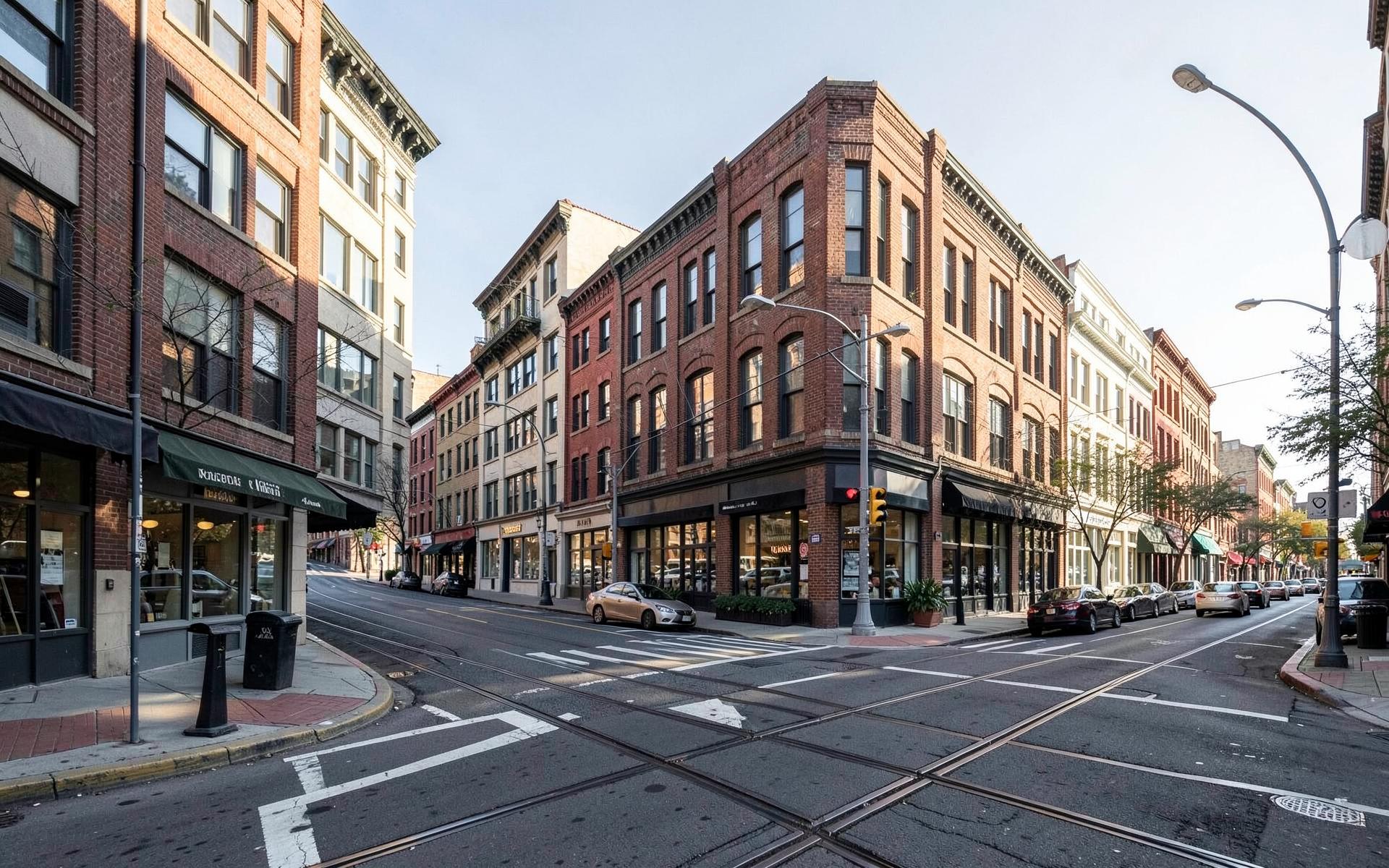
This is where the corridor's mixed-use rebuild is most visible: newer buildings with retail or restaurant space at street level and apartments above, replacing older strip-commercial buildings on some parcels while others still stand. It is also the stretch where the Gold Line streetcar most defines the streetscape.
1500 block
The restaurant blocks
The avenue's most walkable commercial stretch, and the part residents actually mean when they say they can walk to dinner. Small-footprint buildings, patios, and a tenant mix that changes over time — which is why this guide names blocks rather than asserting which specific business occupies a given address today.
1600 block and east
Handing off to the neighborhood
Commercial intensity tapers here and the avenue starts behaving like a residential street again as it approaches the interior of the historic district and the streets around Independence Park. Houses begin fronting the avenue directly, which is a materially different proposition from a house one block back.
Why this guide names blocks and not tenants
A commercial corridor's tenant roster turns over continuously — restaurants close, concepts change hands, medical and campus uses expand into buildings that used to be retail. A page that claimed to list what occupies each address would be wrong within months, and wrong information about a specific address is worse than none. What does not churn is the corridor's structure: which stretches are institutional, which are mixed-use redevelopment, which are walkable small-footprint commercial, and where the avenue turns residential. That structure is what this page documents.
How to verify a specific address yourself
Three public records answer nearly every question about a corridor parcel. Mecklenburg County's Polaris viewer gives you the parcel boundary, land use, and building data. The county tax record gives ownership and assessed value. Charlotte's historic district map tells you whether design review applies to the exterior. Between the three you can confirm what a building is, who owns it, how old it is, and what you would be allowed to change — before you rely on anything a listing or a guide says about it.
Buying or renting on the avenue
Corridor property is a different asset from an interior bungalow, and it should be underwritten differently. Traffic volume, streetcar proximity, ground-floor commercial neighbors, and the pace of redevelopment on adjacent parcels all move value in ways that do not show up on a comparable-sales report for the neighborhood as a whole. If you are weighing a corridor address, read it alongside the neighborhood's for-sale market and, if you are renting first, the rentals guide.
Internal links
Continue along the corridor
The streets, buildings, and institutions that define Elizabeth Avenue.
Checking a specific address
Corridor parcels are priced by block, not by street name
Two Elizabeth Avenue addresses a half mile apart can be entirely different investments. Peters & Associates can pull the parcel record, comparable sales, and zoning context for a specific corridor address before you commit.
Charlotte Real Estate
Peters & Associatesyourleaderinluxury.comAdvertising disclosure. This is a paid or affiliated relationship: the firm above is affiliated with or compensates the publisher of this independent guide, and contacting it may result in a commercial engagement. It does not buy editorial placement. Full disclosure.
Questions & Answers
Frequently asked questions
Direct answers to what readers most often ask about this section of the guide. Each answer cites the primary source it rests on.
All Elizabeth questions →How is Elizabeth Avenue numbered, and where does it start?
Address numbers rise as you move east from the uptown end. The lower hundreds sit closest to uptown and the Novant Health Presbyterian campus edge, the 1200s fall near Central Piedmont Community College's Central Campus, and the numbers in the 1400s through 1600s carry the corridor's commercial and mixed-use core before the avenue becomes residential in character. That numbering is the fastest way to place an address you have only seen in a listing.
How do I find out what is actually at a specific Elizabeth Avenue address?
Use Mecklenburg County's Polaris property viewer and the county tax record for the parcel: they give you the current owner, land use classification, building age, and lot dimensions for an exact address. Tenant occupancy on a commercial corridor changes far faster than any guide can track, so treat parcel records — not a website's list — as the authority for what a given address is.
Which blocks of Elizabeth Avenue are in the historic district?
The historic district boundary does not follow the whole avenue, and a corridor address can be inside it, adjacent to it, or well outside it. Because design review only applies inside the boundary, check the specific parcel against Charlotte's historic district map before assuming what you can and cannot change on the exterior.
Does the streetcar run the full length of the avenue?
The CityLYNX Gold Line operates along a route that includes Elizabeth Avenue, connecting the corridor to uptown and the Charlotte Transportation Center, but its stop spacing means some blocks are a genuinely short walk to a platform and others are several minutes away. Confirm current stops, hours, and construction detours with Charlotte Area Transit System.
Source: City of Charlotte tree canopy and tree ordinance program
Is a house fronting Elizabeth Avenue a worse buy than one a block back?
Not worse — different, and priced differently. Avenue-facing property trades traffic noise, headlights, and less backyard privacy for the shortest possible walk to restaurants, transit, and the two campuses. Interior blocks trade that convenience for quiet and canopy. Both sit inside the same neighborhood and both have committed buyers, so the question is which tradeoff you want to live with, not which address is objectively better.
Source: City of Charlotte tree canopy and tree ordinance program
Are there apartments on Elizabeth Avenue itself?
Yes — most of the neighborhood's purpose-built rental inventory is on this corridor rather than on interior streets, concentrated in newer mixed-use buildings and older low-rise walk-ups. The rentals guide covers what those buildings differ on: parking rights, utility costs, and lease terms.
Source: City of Charlotte tree canopy and tree ordinance program
Our Sources
How this page was researched
This guide is independently written and verified against primary public records and official organizations. It is not affiliated with, endorsed by, or representing any neighborhood association, hospital, college, school district, or governing body.
Read our full citation methodology and editorial standards- 01POLARIS 3G property and parcel records
Mecklenburg County GIS
Parcel boundaries, lot sizes, ownership, and sale history.
- 02Property tax and assessed value records
Mecklenburg County Assessor's Office
Assessed values, revaluation cycles, and tax rates.
- 03Local historic district design standards and review process
City of Charlotte Historic District Commission
Certificate of Appropriateness requirements for exterior work.
- 04Transit routes, the Gold Line streetcar, and commute planning
Charlotte Area Transit System
Streetcar, bus, and rail options serving the neighborhood.
- 05Central Piedmont Community College — Central Campus
Central Piedmont Community College
The college campus adjoining Elizabeth Avenue.
- 06Novant Health Presbyterian Medical Center
Novant Health
The medical campus anchoring the neighborhood's western edge.
Figures such as pricing, assessments, business hours, and school assignment change over time. Always confirm current details directly with the source before making a decision.
Topic Cluster
Living in Elizabeth
Dining, parks, schools, transit, and the daily rhythm of the neighborhood.
The Elizabeth Guide — Living in Elizabeth →Elizabeth Avenue
The neighborhood's main street: streetcar, college, restaurants, and redevelopment.
Continue →Elizabeth Apartments & Rentals
Where the rental inventory sits, what it costs, and what a lease here should spell out.
Continue →Transit & the Gold Line
The streetcar, bus routes, uptown commute, and airport drive times.
Continue →The Elizabeth Historic District
Designation, boundaries, and what review means before you touch a façade.
Continue →Local Expertise
Work with the firms behind this guide
Last reviewed August 1, 2026. This guide keeps no contact form and no inbox — inquiries go directly to the firms below.