Journal · September 14, 2026
Walking to Uptown Charlotte from the Elizabeth Core
A block-by-block account of pedestrian routes, streetcar connections, and terrain shifts between residential Elizabeth and center city Charlotte
Leaving the canopy of the residential interior
The walk begins on residential streets framed by mature willow oaks, deep front porches, and continuous concrete sidewalks. On streets like Clement, Greenway, or 8th Street, the pedestrian environment is buffered by planted strips and steady residential setbacks. Footing is generally level throughout the neighborhood interior, though older sections of pavement feature occasional heave from mature root systems. Traffic on these residential side streets moves at neighborhood speeds, making the initial stretch of an uptown commute quiet and low in stress.
As pedestrians make their way westward toward Hawthorne Lane, the domestic character of the neighborhood begins to yield to institutional and commercial footprints. The transition is gradual: large Craftsman residences and brick Foursquares sit opposite small professional offices, corner medical buildings, and neighborhood retail. Foot traffic increases notably as residents merge toward the primary westbound connectors: East 7th Street, East 4th Street, and Elizabeth Avenue.
Navigating the institutional corridor
Hawthorne Lane marks the western threshold of purely residential Elizabeth and introduces major civic infrastructure. Pedestrians cross paths here with the campuses of Novant Health Presbyterian Medical Center and Central Piedmont Community College. Sidewalks widen along these blocks to accommodate hospital staff, students, and transit riders, while street lighting shifts from residential post-top fixtures to high-output municipal standards.
Navigating this stretch requires attention to crosswalks, ambulance bays, and campus parking decks. The pace of the walk changes from a quiet stroll to an active urban crossing. Signalized intersections at Hawthorne Lane, Caswell Road, and Kings Drive provide designated pedestrian phases, though turning vehicles entering medical facilities require steady awareness. For prospective buyers evaluating how proximity to these corridors affects daily routines, Peters & Associates can help contextualize street-level activity throughout the different residential pockets of Elizabeth.
The descent along Elizabeth Avenue
Elizabeth Avenue offers the most direct and pedestrian-oriented route down toward the center city boundary. The street descends steadily toward Kings Drive, tracing the historical trolley corridor that originally spurred the neighborhood's growth at the turn of the twentieth century. Wide brick-accented sidewalks, pedestrian-scale streetlights, and dedicated CityLYNX Gold Line streetcar tracks define this corridor.
At the base of the hill, Elizabeth Avenue crosses Kings Drive and intersects with the Little Sugar Creek Greenway system. This low point marks both a topographical shift and an ecological transition within the route. Pedestrians benefit from clear sightlines and wide refuge islands at the Kings Drive intersection, though wait times for pedestrian walk signals during peak morning and evening travel hours can add a couple of minutes to an otherwise brisk walk.
Crossing the freeway barrier into center city
The boundary separating Elizabeth from uptown Charlotte is defined by the Interstate 277 loop. Pedestrians entering the center city must cross above the sunken highway via bridge structures on 4th Street, Trade Street, or Elizabeth Avenue as it transitions into 4th. These overpasses are engineered with protective pedestrian fencing, concrete parapet walls, and wide walking decks, but they represent the windiest, loudest, and most exposed stretch of the entire commute.
Once past the freeway structure, the environment shifts immediately into uptown's First and Second Wards. The dense street grid of center city Charlotte takes over, characterized by high-rise commercial architecture, sheltered plazas, and heavy midday foot traffic. The change in scale is dramatic: in under fifteen minutes of continuous walking, a commuter moves from a residential front-porch environment to the financial center of the region.
The CityLYNX Gold Line streetcar alternative
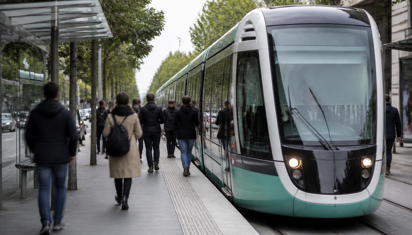
For days when summer humidity, winter rain, or tight schedules make a full walk impractical, the CityLYNX Gold Line streetcar mirrors the primary pedestrian route along Hawthorne Lane and Elizabeth Avenue. Running in mixed traffic and dedicated center-lane alignments, the streetcar connects neighborhood boarding platforms directly to the Charlotte Transportation Center and Trade and Tryon in the heart of uptown.
Service frequency and real-time vehicle arrivals are tracked through the Charlotte Area Transit System (CATS) digital tools. The streetcar provides level boarding for strollers and bicycles, offering Elizabeth residents an easy hybrid commute where one can walk into uptown in the morning and ride the rails back uphill in the evening. This integrated transit line reinforces the neighborhood's original historic design as a direct streetcar suburb.
Seasonal realities and elevation factors
Walking from Elizabeth into uptown involves an elevation drop on the westbound trip and an uphill climb returning home. While the slope along Elizabeth Avenue or 7th Street is manageable for most daily walkers, the western afternoon sun can make the uphill summer commute significantly warmer than the morning descent. The mature tree canopy of residential Elizabeth provides substantial shade, but the open overpasses over the freeway loop offer no natural sun protection.
Winter walking brings clear sightlines through defoliated trees and cooler pavement temperatures. Morning ice is rarely an issue on city-maintained sidewalks, though pedestrian bridges over the highway loop freeze faster than neighborhood paths during winter weather events. Choosing between 4th Street, 7th Street, or the Elizabeth Avenue corridor allows regular walkers to tailor their route based on wind exposure, signal timings, and personal stride.
Internal links
Read this next
The reference pages that carry this subject in more depth.
Recent journal entries
- September 21, 2026Fitting a Modern Kitchen into a 1920s Elizabeth HomeHow original floor plans dictate renovation strategy, structural changes, and trade sequencing in historic Elizabeth kitchens
- September 7, 2026Living Under the Willow Oak Canopy in ElizabethUnderstanding how mature street trees shape daily life, property maintenance, and structural additions across Elizabeth
- September 6, 2026Porch Details That Date an Elizabeth BungalowHow brick piers, battered columns, and decorative brackets reveal the construction decade of an Elizabeth home and direct its structural repair
Local representation
Applying this to a specific address?
This entry describes how things generally work in Elizabeth. Peters & Associates can tell you how it applies to one street, one block, and one house.
Charlotte Real Estate
Peters & Associatesyourleaderinluxury.comAdvertising disclosure. This is a paid or affiliated relationship: the firm above is affiliated with or compensates the publisher of this independent guide, and contacting it may result in a commercial engagement. It does not buy editorial placement. Full disclosure.
Questions & Answers
Frequently asked questions
Direct answers to what readers most often ask about this section of the guide. Each answer cites the primary source it rests on.
All Elizabeth questions →How long does it take to walk from Elizabeth to uptown Charlotte?
From the center of residential Elizabeth near Independence Park or Hawthorne Lane to the center of uptown at Trade and Tryon is approximately 1.2 to 1.8 miles. Depending on personal pace, route choice, and intersection signal timings, the walk typically takes between 20 and 35 minutes.
Is the walk between Elizabeth and uptown Charlotte safe for pedestrians?
The route features continuous concrete sidewalks, signalized crosswalks, and dedicated pedestrian bridges across the Interstate 277 highway loop. Walking along Elizabeth Avenue or East 4th Street provides consistent lighting and wide pedestrian paths, though commuters should remain alert at hospital driveway entrances and freeway ramps.
Source: City of Charlotte tree canopy and tree ordinance program
Where can I catch the streetcar from Elizabeth into uptown?
The CityLYNX Gold Line streetcar operates along Hawthorne Lane and Elizabeth Avenue, with several sheltered platform stops within the neighborhood, including stations near Novant Presbyterian Hospital and Central Piedmont Community College. CATS publishes current operating schedules and route maps online.
Source: City of Charlotte tree canopy and tree ordinance program
What is the most scenic walking route into center city?
A common route begins through the shaded interior streets of Elizabeth, passes through or alongside Independence Park, follows the paved paths along Elizabeth Avenue down past Little Sugar Creek, and crosses into uptown via the 4th Street bridge, offering sweeping skyline views as you approach.
Source: City of Charlotte tree canopy and tree ordinance program
Our Sources
How this page was researched
This guide is independently written and verified against primary public records and official organizations. It is not affiliated with, endorsed by, or representing any neighborhood association, hospital, college, school district, or governing body.
Read our full citation methodology and editorial standards- 01POLARIS 3G property and parcel records
Mecklenburg County GIS
Parcel boundaries, lot sizes, ownership, and sale history.
- 02Local historic district design standards and review process
City of Charlotte Historic District Commission
Certificate of Appropriateness requirements for exterior work.
- 03Property tax and assessed value records
Mecklenburg County Assessor's Office
Assessed values, revaluation cycles, and tax rates.
Figures such as pricing, assessments, business hours, and school assignment change over time. Always confirm current details directly with the source before making a decision.
Topic Cluster
Living in Elizabeth
Dining, parks, schools, transit, and the daily rhythm of the neighborhood.
The Elizabeth Guide — Living in Elizabeth →Elizabeth Homes & Real Estate
Housing stock, price bands, and how this small historic market actually trades.
Continue →Elizabeth Neighborhood, Charlotte NC
The whole neighborhood on one page: place, history, architecture, district, market, and daily life.
Continue →Elizabeth Market Data
Price per square foot, inventory, and what drives value street to street.
Continue →Communities, Buildings & Enclaves
Every pocket, condo building, and infill community in and around Elizabeth.
Continue →Local Expertise
Work with the firms behind this guide
Last reviewed August 1, 2026. This guide keeps no contact form and no inbox — inquiries go directly to the firms below.